C2 San Pere de les Maleses
Overview:
The ‘objective’ of this walk is the ruined monastery of San Pere de les Maleses, which is located under the dramatic cliffs of the Congost de Collegats. However its main value are the spectacular views over and into the ravine itself as well as the surrounding countryside. As one enters the ‘secret’ barranc of Sant Pere there is a sense of walking back into pre-history; a sensation increased by the brooding cliffs and the ever present vultures circling overhead and landing on their roosts. The walk is clearly signposted and forms a round trip, beginning and ending at the picnic site at the southern end of the ravine, the ‘Font de Figuereta’. By doing the route clockwise the last leg, which is part of the ‘A2 – Collegats’ walk, is easy walking along the riverbank, cool and shady! NB this route is probably the most arduous in our categories. It is also very exposed to the sun, so precautions should be taken on very hot days.
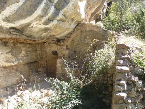
The ‘Monastery’, what’s left of it!
History:
The ‘monastery’ – it’s really hardly more than a hermitage – was first recorded in 868 as an independent entity but at some point it was incorporated into the Benedictine monastery at Gerri de la Sal (see History and Pallars Sobirà guides). It remained in regular use as a priory until the XVII C when it was abandoned but still used as a sanctuary and for specific ceremonies. It fell into disuse, however, during the XIX C and is recorded as being in ruins from the beginning of the last century. In Catalan malesa means illness or disease, so presumably the monastery was dedicated to the infirm, even if it was not an actual infirmary. Its isolation would be excellent for contagious diseases, of course, but it was more likely to have been a place of pilgrimage; perhaps it’s too cynical to suggest that if the infirm could get this far there can’t have been too much the matter with them!
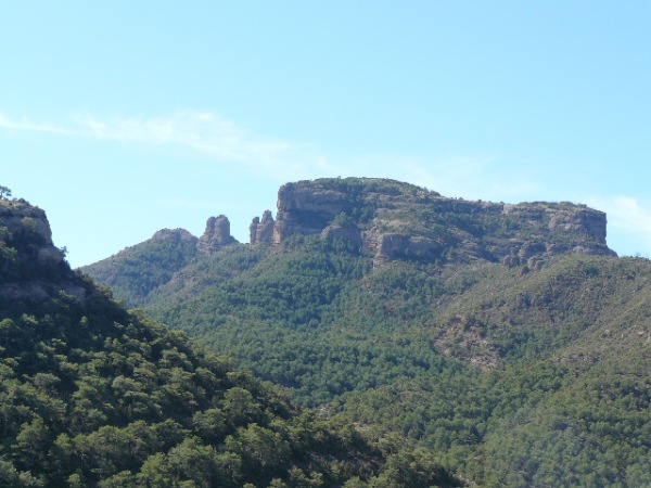
The view over the Roca de l’Eslugueta as seen from the trail
Nature:
The Congost de Collegats cuts through the Boumort massif, which consists of deep limestone strata interspersed with conglomerate rock, resulting in dramatic ‘tor’ structure, e.g. the Roca de l’Eslugueta, above the village of Hortoneda, which dominates the landscape to the south east of the Congost. Thanks to water erosion the limestone cliffs provide habitats for nesting birds, especially vultures. Griffon vultures roost here and the walk is ideal for viewing them. Bearded vultures can often be seen. Red and fallow deer stray across the river from the Boumort Reserva Natural, taking advantage of the swathes of uninterrupted woodland, mainly black pine that thrives of the limey soils. Along the riverbank herons can frequently be seen along with kingfishers and other waterfowl, and there is a noted population of otters and even genuine wildcats! Returning to geomorphology, the other specific feature of the walk, La Cova de la Serpent, is encountered near the apex of the trail, over 200 metres above the river. Indside, the mystery of the name is revealed; in the ‘ceiling’ of the main chamber there is a lesser chamber whose ‘floor’ has collapsed. The sinuous form of this chamber make it look serpentine indeed!
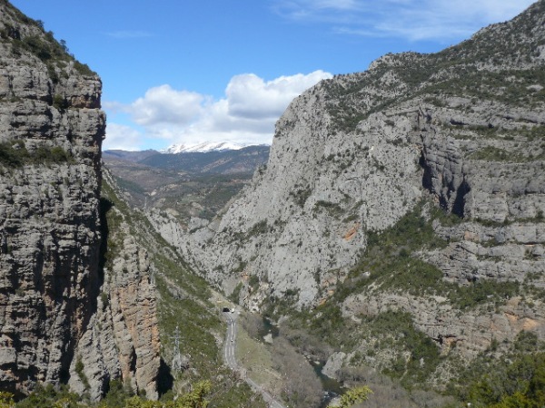
The Congost de Collegats is the gateway to the area of the High Pyrenees
The Walk:
From the car park the trail starts by following a lane that climbs steeply away from the main road on the opposite (west) side of the road, where a board shows details of the walk. About half a mile along the lane the trail proper is signposted to the right. From here on yellow daubs indicate the way. This section is steep but quite short, however, and it ends at the foot of an outcrop of conglomerate, where it joins a near horizontal path from Gramuntill. This path is graced with small cairns to show the way but no yellow marks are visible here: turn right towards the cliffs of the Tossal de Cap. From here the path follows gently shelving rocks which trend downhill to a small ‘barranc’ This is crossed by a tiny timber bridge. It’s a good place to stop, as the dank woods are very cool.
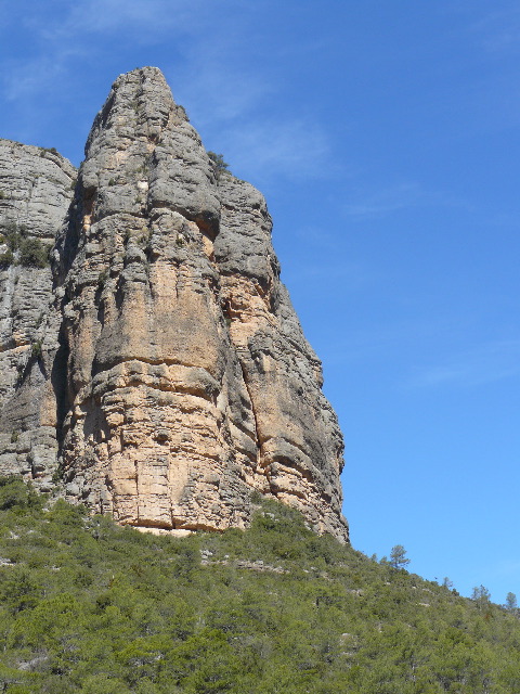
The cliffs of the Tossal de Cap
From here the path leaves the wood and works its way circling around the foot of the Tossal de Cap and into the barranc de Sant Pere itself. Here the woods become very dense and there are dank mossy banks, which provide habitats for a variety of wild flowers. The cliffs opposite at pockmarked with holes which host colonies of swifts and other rock dwelling species. Well into the barranc there is another signpost: onward to the Monastery (10 minutes) and down toward a ford over the stream towards the ‘Cova de la Serpent’. A few yards along the past to the Monastery there is a mirador’that gives a fabulous view. Still further on the path splits again. Instead of gong onwards follow the steep timber built stairway down to the stream. Carefully cross amobg the boulders cross here and follow the faint pasth as it doubles back through dense woodland until you stumble across the ‘Monastery’ – this is it!
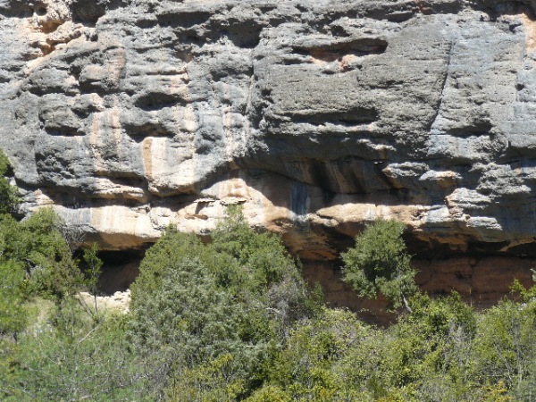
The Monastery is in there somewhere, complete with its maintenance-free roof!
Back to the ford, here the stream crosses smooth shelving rocks and it is ideal to take a long break as it is the halfway mark and the cooling water is ideal preparation for the very exposed section to come. Also, there are rock pools just upstream suitable for bathing! Leaving the ford the path sets off uphill to the right. The yellow daubs forsake it permanently from here on but the cairns continue and the path is unmistakable from here on. At the top of the slope the trail enters a area of burned forest. This is rather desolate but soon there is the compensation of re-joining the Collegats ravine. Looking down into it the old road is visible, which is reassuring as until now there hasn’t been much sense of northerly progress! Here, at about 200 metres above the river, it is vertiginous indeed! The Cova de la Serpent is towards the end of this fairly level section, following which a steep zigzag climbs to the only nasty bit of the walk; a short exposed section right under the cliffs with no handholds – but it’s only a few metres! Continuing onward, the trail leads steeply back down to the ravine to reach the main road between the two tunnels. Head home but follow the old road, which goes along the riverbank, all the way back to the car park: NB see Walk A2 – Collegats, for this section.
You must be logged in to post a comment.