B1 Congost de Montrebei
Overview:
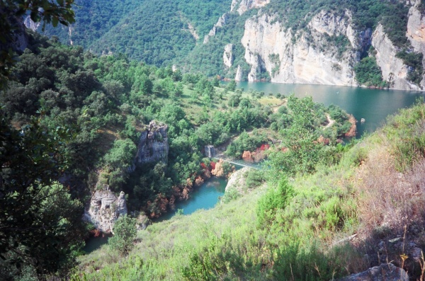
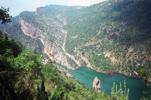
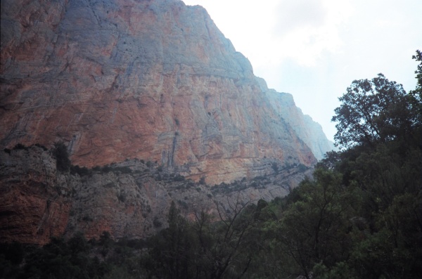
The path is cut into the sheer cliff several hundred feet above the still waters below, the river here being dammed many miles further downstream. It is a three-hour walk to and from the visitor centre with fantastic views of the cliffs that form the south face of the Montsec d’Ares and back through the ravine towards the high mountains in the distance, guarded by a dramatically situated watchtower, the Castell de Girbeta. This walk is graded C partly because of the path itself but mainly because of the ‘Fear Factor’! But it is probably the most popular excursion we have described, so don’t be intimidated – you can always turn back! NB. The final access to the ravine crosses a suspension bridge whose walkway is made of steel grating, so dogs would have to be carried over this.
History:
The concentration of castle towers around the Congost, especially the Castell de Girbeta on the opposite bank, give a clear idea of how sensitive this area was during the years of the Moorish occupation of the areas to the south of the Montsec. In fact many of these towers served as observation and communications posts. Each one is visible from several others and by virtue of a system of flags and flares warnings of enemy incursions could be passed quickly and defending forces gathered. Fígols’ castle, Montllobar, was an important link in this system as it looks over the two river valleys (see walk A1). Just as important, perhaps, as the physical communication between these towers is what might be called the ‘meta-communication’ that they symbolised. The workings of the feudal system were complex; the nobility not only ruled by rights and privileges but also by a form of consent, based on obligations to their vassals. Right up and down the line, from the lowly ‘villain’ to the ruling Counts of Barcelona, a complex set of rules and precedents bound the society together, all based on sacred oaths. These were established and renewed at special ceremonies that took place in these castles, which have a characteristic form: the ground floor being a store room for arms and supplies (it took a bigger castle like Mur to house knights with horses), the middle floor for living quarters for the baron, his family and minions, and a second floor which was only used for the sake keeping of relics, bibles, etc. on which oaths of allegiance were physically taken – just like in modern day law courts!
The Congost of Mont-rebei was indeed used for invasion attempts by the Moors, in 1041 and 1048, after the system of maintaining an uneasy peace by the use of hostages broke down (yet again). The latter incursion provoke local warrior hero, Arnau Mir de Tost, to successfully inavde the Val d’Ager on the southern flank of the Montsec, although it is not known which route his armies would have taken as there is a pass, the Coll d’Ares, over the mountain here too (there are marked walks over this – ask for details at the visitor centre). The proliferation of hermitages, readily visible from the walk, followed in more peaceful times. Most are examples of early Romanesque architecture dating from around the XII Century.
The Noguera Ribagorçana forms the frontier between Catalonia and Aragon. But there has never been any bellicose relations between the two countries, however, and in fact the became united as early as 1137 when the then Count of Barcelona, Ramon Berenguer IV married Petronella, heir to the Throne of Aragon.
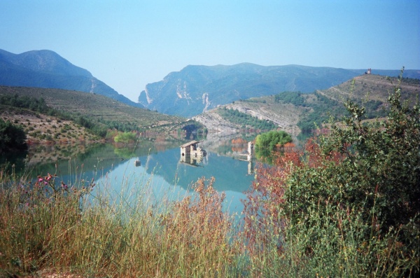
From then until modern times the Congost was a drover’s route through from the plains to the high mountain pastures. ‘Transhumance’ was an important feature of Spanish life until very recently; indeed it is still practised in some areas. In fact drover’s routes, called ‘Cañadas Reales’ (carrerada in Catalan), have incontrovertible privilege by royal decree. Every year shepherds drive flocks right through the centre of Madrid to reaffirm this right. There are over 125,000 kms of official Cañadas in Spain and the Congost de Mont-rebei is on one of these routes. It was for this reason that the builders of the Canelles reservoir had to cut a nominal path above the waterline. The mystery of the ‘disused’ lower path, visible from certain points, is that the reservoir failed to fill to its full extent due to leakage into cave systems in the limestone, (it only has 679 million cubic metres’ capacity instead of the theoretical 716 millions!) so the level of the path was set and the path made. But this has changed over time, requiring the new, even more vertiginous, path to be cut!
Nature:
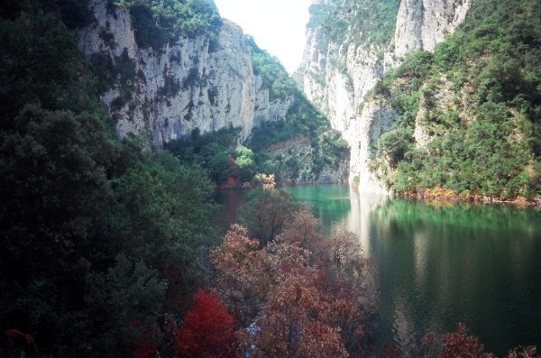
The main fame of the Congost de Mont-rebei is in its bird watching opportunities: in the centre of the ravine, where the cliffs are only a few metres apart, it is common to see wallcreepers (Tichodroma muraria) as they search the opposite rockface, unperturbed by voyeurs of the other side, the only problem is actually seeing them against such a huge backdrop – plus the temptation to lean over the dizzying drop to get a closer view! It’s also worth continuing a few hundred yards beyond the ravine at the far end as far as a large rock that the path has to divert around. From here scan the opposite cliffs where there is a colony of nesting griffon vultures (Gyps fulvus); it’s quite possible to see the ‘chicks’ (they’re about three feet tall!) in springtime, eagerly waiting to be fed. Meanwhile at the northern approaches to the ravine it’s worth looking out for the large population of otters (Lutra lutra), or at least for their signs. This is alaso a good area to see lammergeiers (Gypaetus barbatus) and golden eagles (Aquila chrysaetos chrysaetos).
The Walk:
The path is part of the national GR network (the GR1 in fact) and although in recent years some handrails are provided it is still a vertiginous route! To get there, take the C1311 over the sierra behind Fígols, towards Pont de Montanyana. Just before reaching the village there is a sharp left turn signposted for Castissent and the Congost and the route is well signposted from here. There is a car park and visitor centre about half a mile from the entrance to the ravine. The trail is clearly marked and there are rough timber bridges where it crossed little gullies by the lakeside. There is a hermitage on the cliffs on the opposite bank, Mare de Deu del Congost. Unless the lake is empty you will have to follow the path over a hillock to reach the ravine, but it is very clear and you will notice markers of red and white paint on boulders at salient points. It is worth waiting at passing places if you see groups coming the other way. I should also say, from experience, that if any of the party begin to get vertigo it’s advisable to turn around, the path won’t get any better and there’s only one way back! We end out walk at the Vulture Boulder (see ‘Nature’, above), but determined walkers may continue onwards to two further objectives: the hermitage of Mare de Deu de la Pertus and the village of Corça. The hermitage is about the same distance again and the village, which has a bar/restaurant, about half that distance again. There is a mountain refuge, Mas Carlets, about half way along the ‘extension’ to the hermitage, however.
You must be logged in to post a comment.